


Impressions


Trip description
Start from the parking lot shortly after Rein
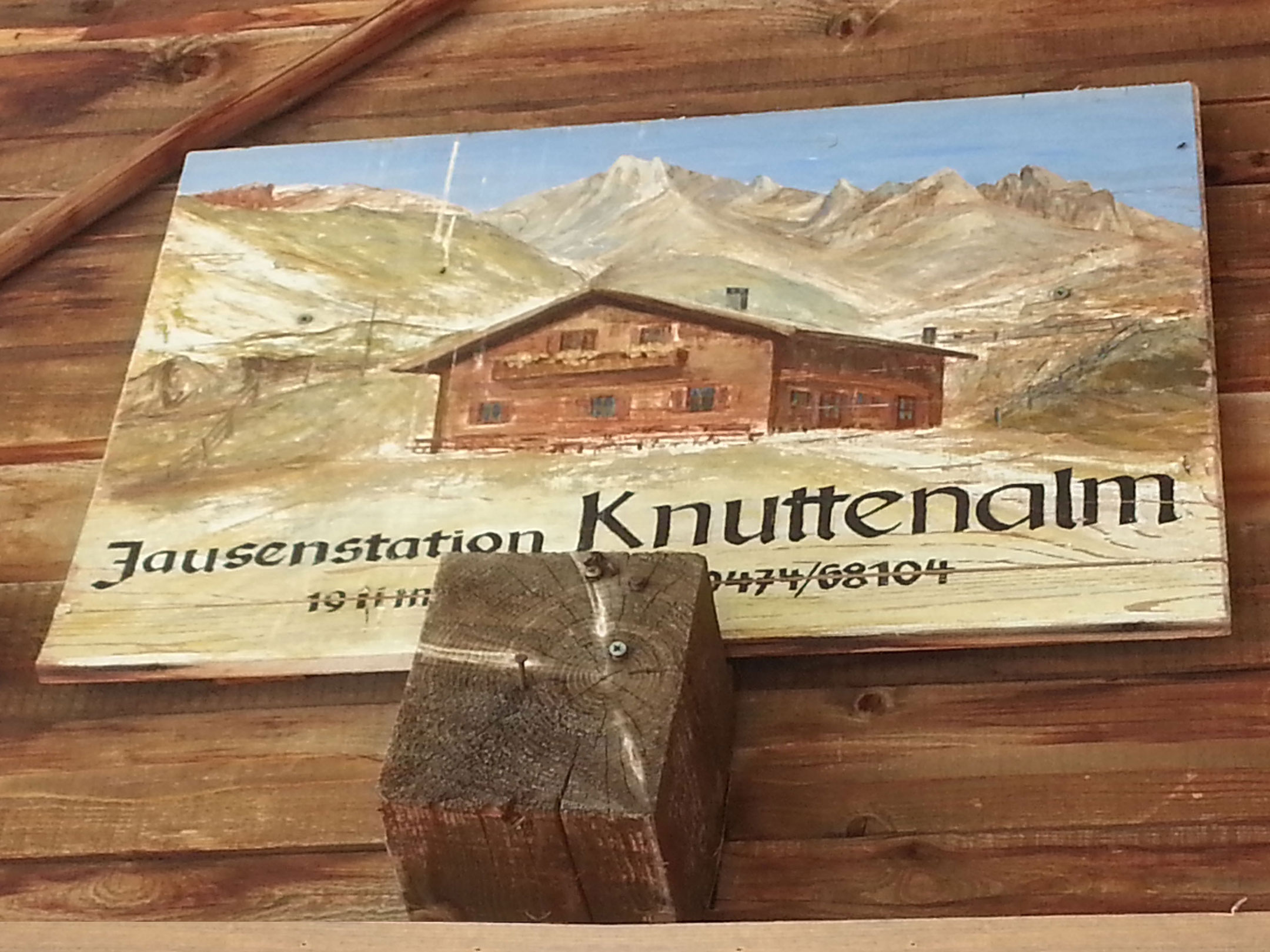
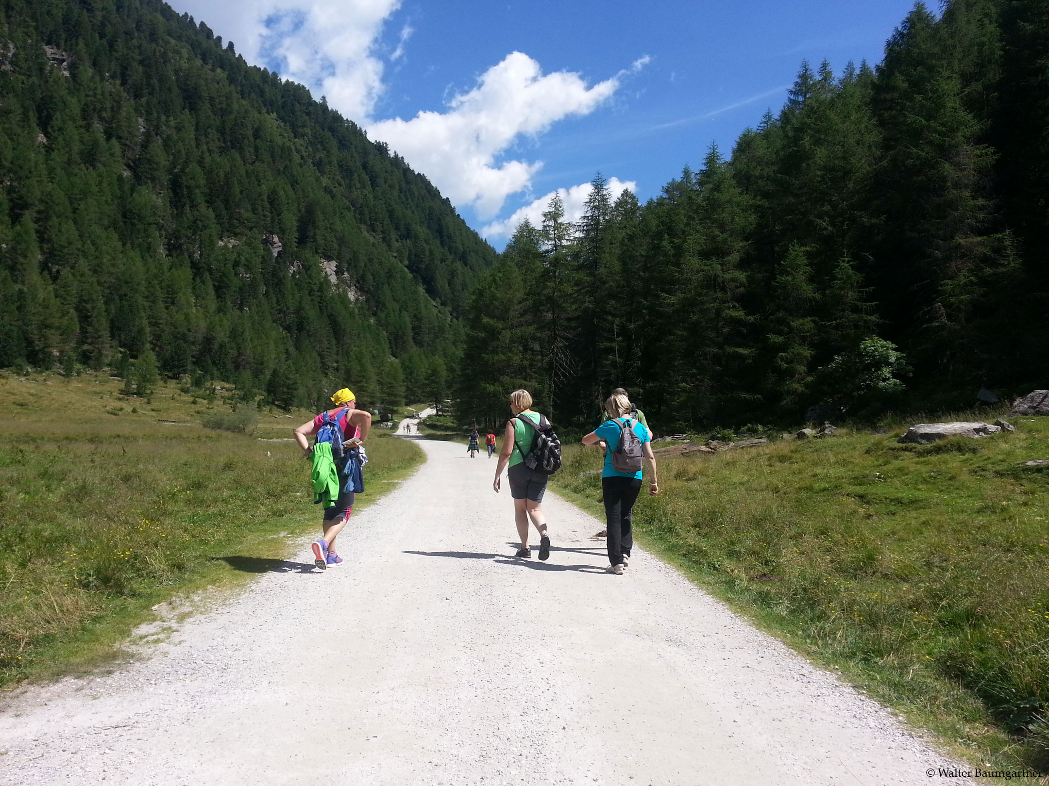
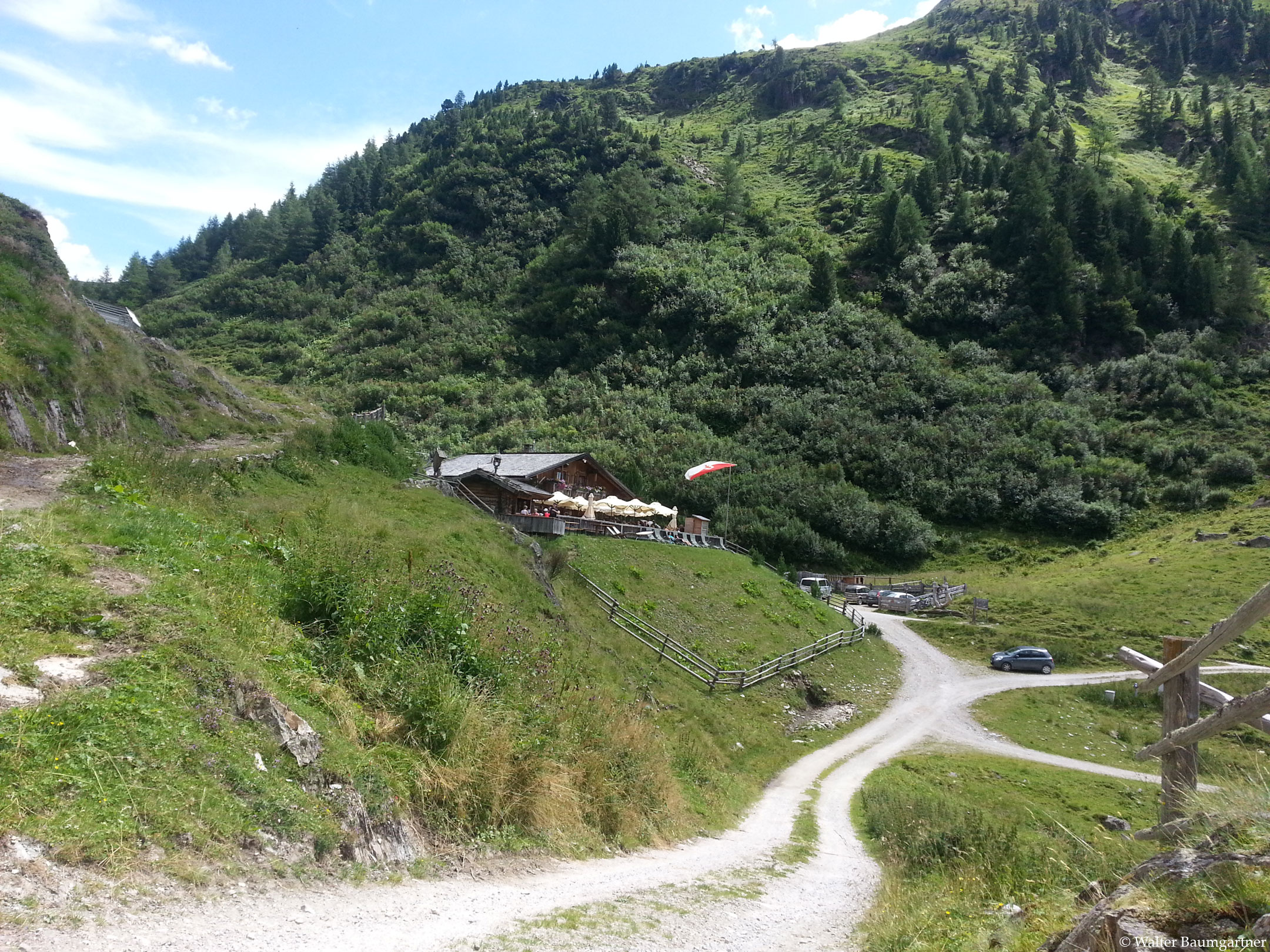
This leisurely route to the Knuttenalm leads through the Rieserferner-Ahrn Nature Parkwhich is one of the seven nature parks in South Tyrol. From the car park shortly after Rein at 1,864 m, the forest path initially leads slightly uphill (for approx. 500 m up to 11% gradient) through the Knuttental valley. A small stream flows along the way and the path is surrounded by mountain pine forests. After about 1 km, the path meanders slowly through the valley with a maximum gradient of 3 % and you can enjoy the surrounding alpine meadows and the view of the Knuttennock and the Weiße Wand. After approx. 2.5 km from the parking lot, the trail gets a bit steeper again (approx. 200 m) in the direction of Knuttenalm, here you can find gradients of up to 15%. However, these are no problem due to the well-maintained forest road. Shortly afterwards you can see the Knuttenalmwhich is a collection of small huts (so-called "Haufensiedlung").
The way back is via the same route.
Tip:
It is possible to hike on to the Klamml See lake at 2,243m. Follow the forest road and leave the Knuttenalm on the left, ignore the next two junctions and slowly climb upwards in several hairpin bends towards the lake. Past the small house, you reach the northern shore, where old barracks can be found.
We haven't tried this tour ourselves yet, but we plan to do it next time and will report back then.
By loading the map, you accept Google's privacy policy.
Learn more
Trail conditions
Wide, comfortable non-asphalted forest road.
Directions
Through the Puster Valley in the direction of Sand in Taufers and from there on to Rein in Taufers.
Time requirement
Outward and return journey as described approx. 2 hours.
Difference in altitude
Approx. 210-230 m.
Suitable wheelchair
- Wheelchair with traction device
- off-road power wheelchairs
Accompanying person
Accompanying persons should not be necessary. It may be necessary to ask guests or the hosts at the ramp to the alpine hut for pushing assistance.
Click the button below to download the content of www.komoot.de.
Level of difficulty
Medium
Explanation
For the most part, this is a rather leisurely hiking trail, but there are steeper sections at the beginning and end of the trail. Possibly the steeper sections - depending on the wheelchair and traction motor - are to be driven backwards.
Resting facilities
Refreshment stops in the alpine village Knuttenalm as well as in the village Rein in Taufers
Tested:
Accessible toilet
There is a barrier-free WC in the Knuttenalm (separate entrance).