Impressions


Trip description
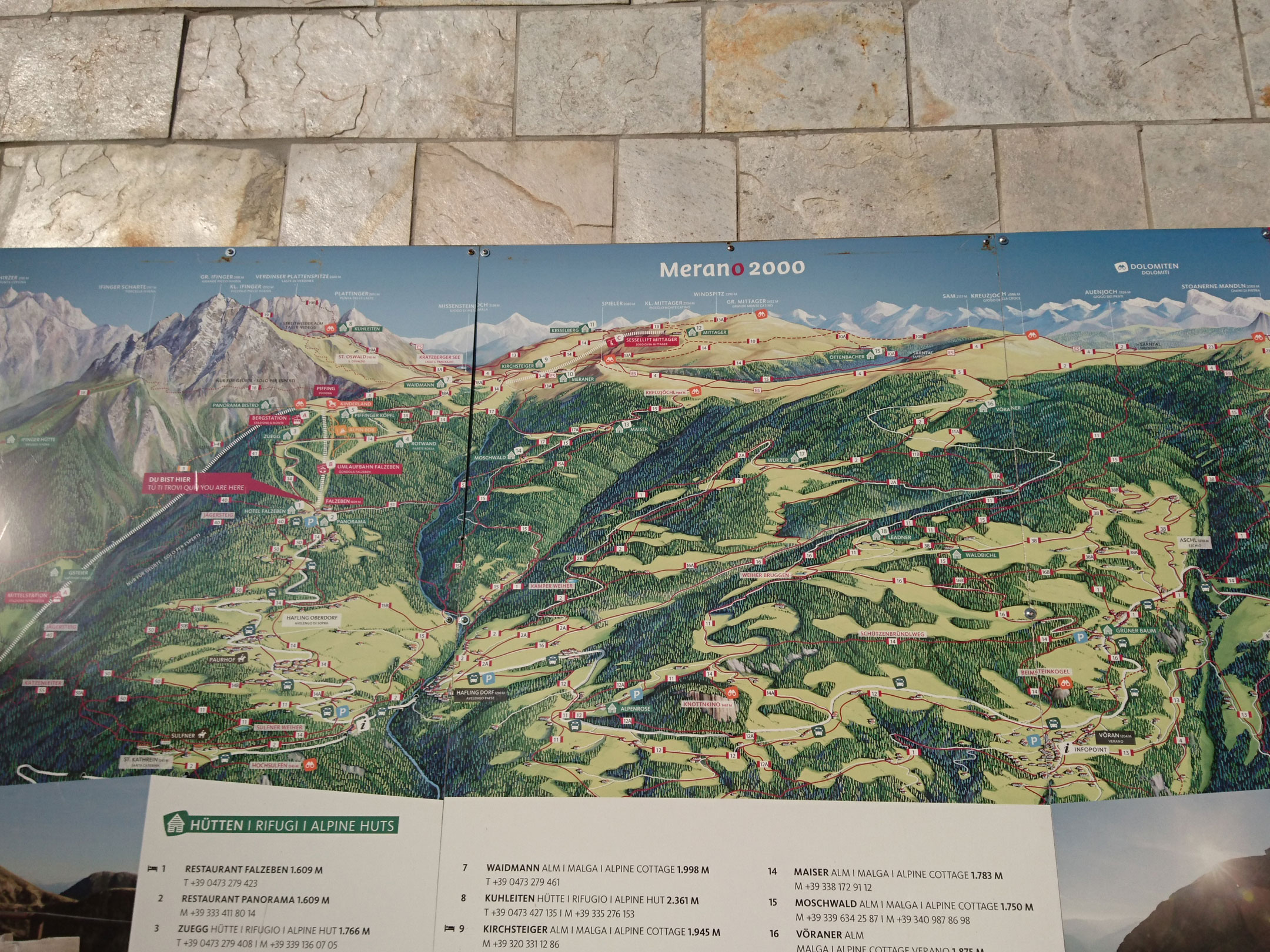
Parking lot of the Merano 2000 station to the Croda Rossa hut
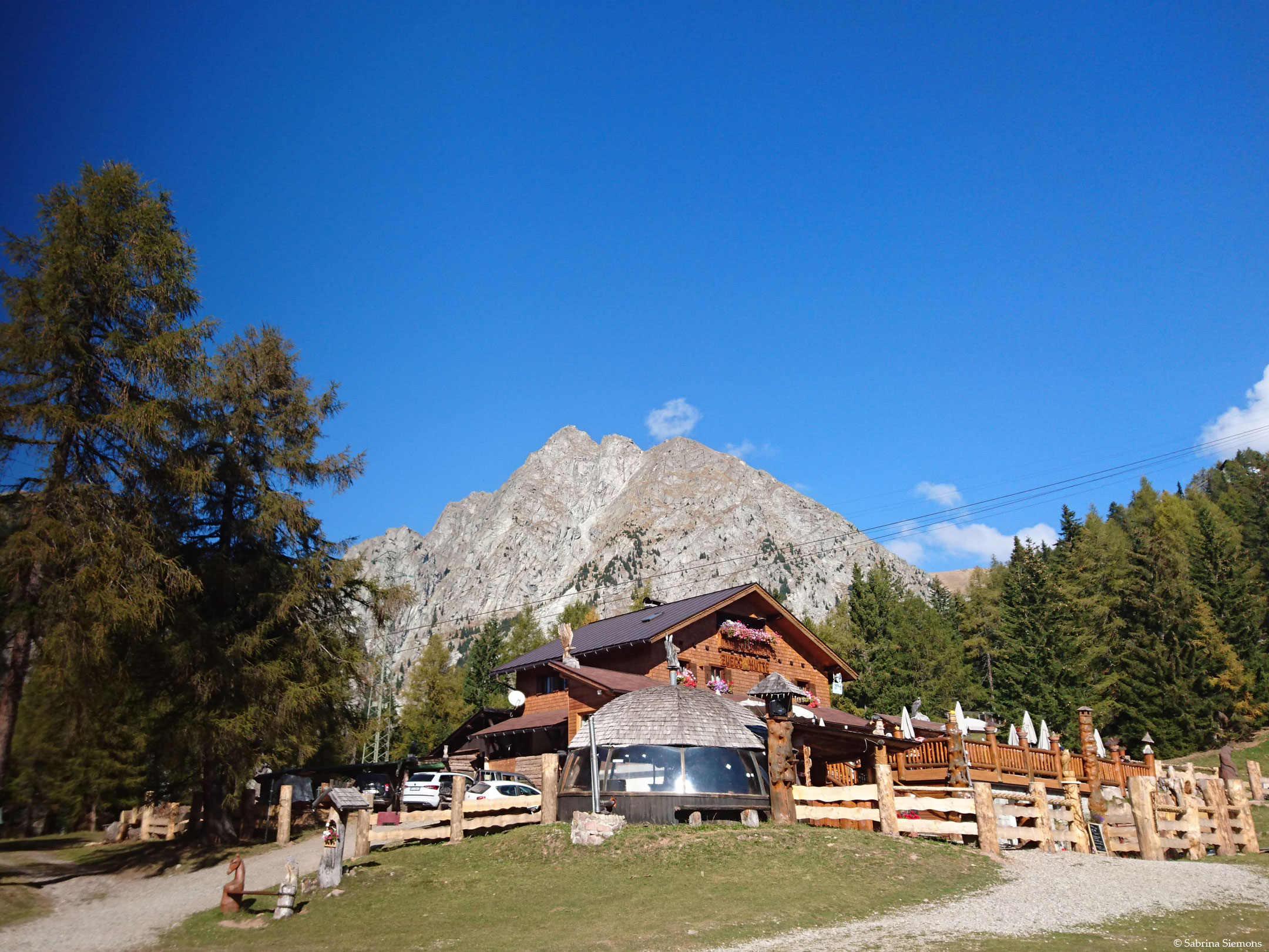
After leaving the car park, we continue straight on and thus pass the Falzeben valley station on the left. After a few meters the asphalt area ends and the forest road starts. This initially leads uphill between the winter toboggan run on the left and the ski slope on the right relatively steeply ( with 13% gradient). After about 500 m the gradient becomes more comfortable again (approx. 10%) and leads through a beautiful forest with occasional views of the surrounding mountains. After about 1 km, trail no. 14 turns left and the forest road continues straight ahead. We follow the forest road, because the hiking trail leads over a pasture, which was not passable at that time. Now follows with up to approx. 15% slope again a somewhat more strenuous part, before you then reach the Zuegghütte reached at 1,766 m.
We continue hiking and follow the forest road in a right-hand bend, which runs with 10% gradient first under the chairlift and then under the summer toboggan run. From the forest road, you have a good view of the toboggan run and can watch the children (and parents) speeding down. (The Web should also be accessible for people with disabilities). After about 2 km since the start, you cross the ski slope with the help of an underpass and take the right path at the following fork in the road towards the Rotwandhütte (1,817 m).
From the Rotwandhütte to the Meraner Hütte
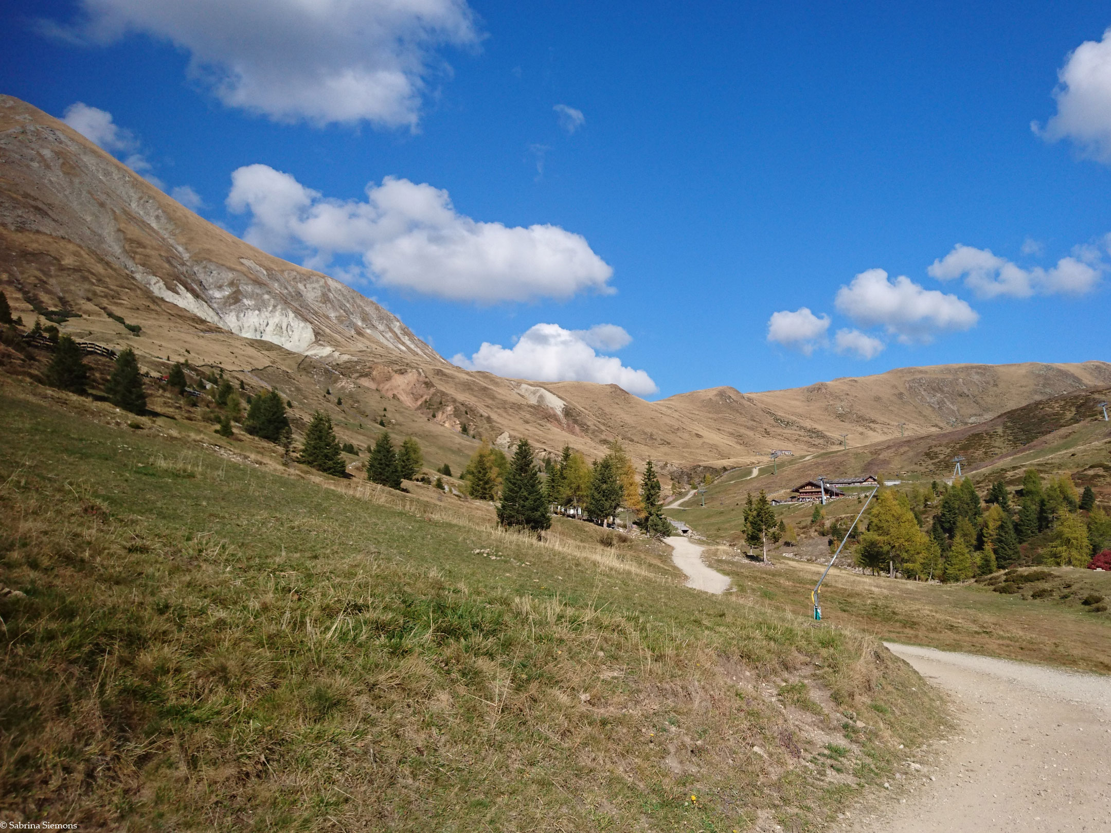
Those who wish can take a short breather at the Rotwandhütte. However, we follow the forest road to the right past the Rotwandhütte. The forest road now joins hiking trail no. 14, which continues in the direction of the Meraner Hütte. The next 1.5 km are almost flat and perfect for "hiking along". Now the plateau opens up and you can already see the alpine pastures and huts at the end of the plateau from afar. This is followed by another 200 m with a gradient of 15%, before the comfortable hiking trail continues, we leave the forest and can fully enjoy the view of the Ifinger (2,581 m) and the Plattenspitze (2,680 m). Shortly before the Kirchsteiger Alm (1,945 m) there is another short ascent, which however - if you continue to follow the forest road and not the shortcut - is easy to manage. Barely 5 minutes later we are at the Merano hut (1.960 m).
The way back is the same as the way there.
Tip: Öttenbacher Alm
From the Meraner Hütte there are various options for continuing the hike. One of them is the path to the Öttenbacher Alm, which is relatively pleasant with gradients up to 10%. There and back are about 6.5 km and the total time is extended by 2 hours.
Trail conditions
Continuously wide, unpaved forest road with fine gravel, partly short stretch with forest road.
Directions
From Merano in the direction of Hafling and from there on to Falzeben.
4 ♿ parking spaces directly at the Merano 2000 station in Falzeben, free of charge with disabled pass.
Time requirement
There and back in total about 3 hours.
Difference in altitude
There are about 350 meters of altitude to overcome.
Suitable wheelchair
- Manual wheelchair with a strong traction device
- off-road power wheelchairs
Accompanying person
An escort is not necessary on this tour, as the slopes are well manageable with a strong traction motor. Shortly before the Kirchsteiger Alm it goes a little more uphill, here you can possibly ask passers-by about pushing help.
Level of difficulty
Medium
Explanation
The trail to the Meraner Hütte does not present any major difficulties, with a maximum gradient of 15%. In addition, the path is mostly well built and easy to ride. Now and then there can be problems due to the loose ground because of spinning wheels, but with an escort or the help of other hikers this is not a problem. We have classified this tour in the red difficulty level mainly because of the gradients.
Resting facilities
Zuegghütte, Rotwandhütte, Kirchsteiger Alm, Meraner Hütte, Öttenbacher Alm
Tested:
Accessible toilet
Barrier-free toilets are available at the valley station in Falzeben.