Impressions


Trip description
From the parking lot at the reservoir to Mühlbacher Badl
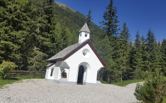
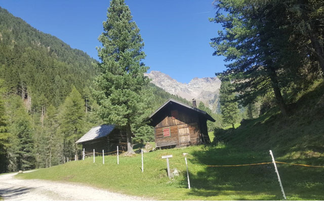
The starting point for our hike is the hikers' car park at the reservoir above Gais, about 2 km from the small village of Mühlbach. From the car park we follow hiking trail no. 2, which is a well-maintained forest trail, up towards Mühlbacher Badl. Hiking trail no. 2 is laid out in such a way that it leads up through the valley with a slight incline into the Riesenferner Ahrn Nature Park. Already after approx. 1 km we reach the Mühlbacher Badl (1,694 m). There is a small healing spring here, which was much visited by locals in earlier times. Today, the Mühlbacher Badl is a mountain inn with a small chapel.
From the Mühlbacher Badl to the Oberwanger Alm
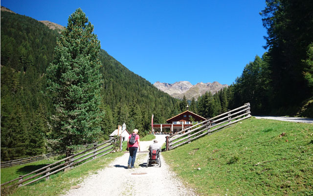
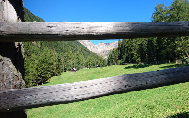
We follow hiking trail no. 2 further past the Mühlbacher Badl. The forest path winds its way through the valley with a slight incline. The surface changes from partly coarse gravel to finer, packed gravel. Further up we pass some alpine huts and cross the small river that runs through the valley. Directly after the river and in front of one of the alpine pastures, the Huber Alm ( 1.854 m), which offers a second refreshment stop on this tour, we have to master the steepest part of this tour with up to 20 %. After the Huberalm we follow the forest road up to the Unterwanger Alm (1,948 m) and to the Oberwanger Alm (2,030 m), where the forest road ends and therefore also represents the final stop for us.
We go back the same way, enjoying the view along the valley.
Trail conditions
Continuous forest road with gravel. Sometimes freshly filled and sometimes quite festgefahre.
Directions
Via Bruneck as far as the village of Percha. There turn left in the direction of Mühlbach/Rio Molino. Just before Riomolino turn right in the direction of Mühlbacher Badl. After approx. 500 m you reach the parking lot directly behind a water catchment basin.
Time requirement
Round trip approx. 3 to 3.5 hours.
Difference in altitude
There are about 400 meters of altitude to overcome.
Suitable wheelchair
- Wheelchair with traction device
- off-road power wheelchairs
Accompanying person
An escort is not necessary due to the well-built forest road. However, if the towing equipment is rather weak or reversing is not possible, an escort is helpful.
Level of difficulty
Medium
Explanation
This is a hike with a slight to moderate gradient, which is easy to master thanks to the well-built forest road. Due to the partly coarse gravel and the short part with a gradient of approx. 20 %, this tour belongs to the medium category.
Resting facilities
Mühlbacher Badl, Huber Alm
Tested:
- Mühlbacher Badl (1,694 m): The terrace of the Mühlbacher Badl has a step, which can be reached by wheelchair by installing a mobile ramp. The ramp is relatively narrow. The interior rooms and the outdoor terrace are generously designed and can be accessed by wheelchair.
Accessible toilet
There is a barrier-free WC in the Mühlbacher Badl.